Alaska Rivers: Kuskokwim River

Alaska Marine Highway

Alaska's State Flower is the "Forget-Me-Not. Forget me not flowers are very fragrant in the evening and night time, though there is little or no scent in the daytime. They can be annual or perennial plants. Their seeds are found in small, tulip shaped pods along the stem to the flower.

The Kuskokwim River or Kusko River is 702 miles  long, stretching through Southwest Alaska.  It is the ninth largest river in the United States by average discharge volume at its mouth and seventeenth largest by basin drainage area. Kuskokwim in Yupik is a loose translation of a Yup'ik word to English. It is a compound word meaning big slow moving thing.


The Kuskokwim River provides the principal drainage for an area of the remote Alaska Interior on the north and west side of the Alaska Range, flowing southwest into Kuskokwim Bay on the Bering Sea. Except for its headwaters in the mountains, the river is broad and flat for its entire course, making it a useful transportation route for many types of watercraft. It is the longest free flowing river in the United States.


The principal economic activities along the Kuskokwim River have historically been fur trapping and fishing. Subsistence fishing for chinook salmon provides a staple of the Eskimo diet along the river. Economic deposits of placer gold were discovered in 1901 near Aniak. Mineral production in the region has mainly been from scattered placer gold deposits that through 2004 had produced a total of 3.5 million troy ounces of gold. The primary route of the Iditarod Trail follows the South Fork Kuskokwim River out of the Alaska Range and crosses the main stem of the river near McGrath.


The Kuskokwim River is formed by the confluence of East Fork Kuskokwim River and North Fork Kuskokwim River, 5 miles (8 km) east of Medfra. From there it flows southwest to Kuskokwim Bay and the Bering Sea. The Kuskokwim is fed by several forks in central and south-central Alaska. The North Fork (250 mi/400 km) rises in the Kuskokwim Mountains approximately 200 miles  WSW of Fairbanks and flows southwest in a broad valley. The South Fork  rises in the southwestern end of the Alaska Range west of Mount Gerdine and flows north-northwest through the mountains, past Nikolai, receiving other streams that descend from the Alaska Range northwest of Mount McKinley.

The two forks join near Medfra, and from there the main stem of the Kuskokwim flows southwest, past McGrath, in a remote valley between the Kuskokwim Mountains to the north and the Alaska Range to the south. In southwest Alaska the river emerges from the Kuskokwim Mountains in a vast lake-studded alluvial plain south of the Yukon River, surrounded by vast spruce forests. It passes a series of Eskimo villages, including Aniak, and approaches within 50 miles of the Yukon before diverging southwest. Southwest of Bethel, the largest community on the river, it broadens into a wide marshy delta that enters Kuskokwim Bay approximately 50 miles southwest of Bethel.

The lower river below Aniak is located within the Yukon Delta National Wildlife Refuge. The river receives the Big River from the south approximately 20 miles  southwest of Medfra. It receives the Swift, Stony, and Holitna rivers from the south at the southern end of the Kuskokwim Mountains before emerging on the coastal plain. Kuskokwim River receives the Aniak River from the south at Aniak. Approximately 20 miles  upstream from Bethel it receives the Kisaralik and Kwethluk rivers from the south. It receives the Eek River from the east at Eek near its mouth on Kuskokwim Bay.

The Kuskokwim River is a prominent natural stream in Alaska. The South Fork Kuskokwim River at a length of 130 miles (210 km), located in Southwest Alaska region of Alaska and draining into the Bering Sea is a beautiful picturesque river to fish or float. The South Fork Kuskokwim River is an excellent place to fish for the well known Alaska Salmon, Rainbow Trout and many other species of fish. The Kuskokwim Management Area includes the Kuskokwim River drainage, all waters of Alaska that flow into the Bering Sea between Cape Newenham and the Naskonat Peninsula, and Nunivak and St Mathew Islands. Commercial and subsistence fishing in this area focuses primarily on salmon and herring. Herring are abundant along the coast of the Kuskokwim area, but there has been little market for commercial herring in some time. Salmon fishing occurs primarily within the main stem of the Kuskokwim River and in Kuskokwim and Goodnews Bays.


Search:

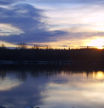
Kuskokwim river in Alaska


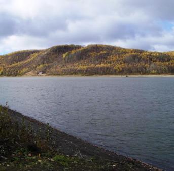
Kuskokwim river is a straight flat river in Alaska


Alaska Rivers:

Alaska has more than 12,000 rivers including the nine major rivers listed below:

Learn more about Alaskan rivers

Colville River Copper River Gulkana River
Kuskokwim River Noatak River Porcupine River
Susitna River Tanana River Yukon River.