Alaska Rivers: Noatak River

Alaska Marine Highway

Alaska's State Flower is the "Forget-Me-Not. Forget me not flowers are very fragrant in the evening and night time, though there is little or no scent in the daytime. They can be annual or perennial plants. Their seeds are found in small, tulip shaped pods along the stem to the flower.

The Noatak is one of the longest untouched arctic rivers. The Noatak River is a classic arctic voyage within the mountain wilderness of Gates of the Arctic National Park. The Noatak is one of the longest rivers in our National Wild and Scenic River system, flowing 425 miles from the glaciers of Mt. Igipak to the Chukchi Sea. Surrounded by the mountains of the Brooks Range for much of its length, this watershed is remote!


The early English name "Inland River" published by surgeon John Simpson, RN, on his 1853 "Native Map," appears to be a general translation of the Inuit name "Nunulak" which he also recorded. The name "Nunatak" could also mean "new land" or "belong to the land."


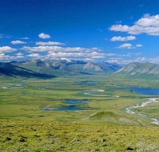
The Noatak River is a river in northwestern Alaska, with headwaters  on 8,570 foot tall Mount Igikpak in the Schwatka Mountains of the Brooks Range in the Gates of the Arctic National Park. The Noatak flows generally westward approximately 419 miles to the Chukchi Sea at Kotzebue Sound. The river's entire course is north of the Arctic Circle. Leaving Gates of the Arctic National Park the river enters the Noatak National Preserve which exactly delineates the river's watershed. The entire watershed of the Noatak River, not just the river itself, lies within these two protected areas, from the headwaters to where it leaves the Noatak National Preserve, which is a point approximately 20 river-miles upstream of Noatak village and 90 river-miles upstream of the river's delta in Kotzebue Sound.


Even on this last part of the river most of the watershed lies within either Noatak National Preserve or Cape Krusenstern National Monument, with only the immediate river valley outside of these protected areas. This is the largest protected watershed basin in the U.S. The Noatak National Preserve alone encompasses 6,500,000 acres. There are small inholdings of private land within the National Preserve, some of these have private cabins. The Brooks Range is an area that wilderness lovers consider to be the greatest remaining wilderness area in North America, and perhaps the world. Stretching 600 miles from the Canadian border on the east to the Arctic Ocean on the west, it is 150 miles wide and acts as the major barrier separating the taiga forests from the treeless expanse of foothills and coastal plains to the north.

The only permanent settlement along the Noatak River is the village of Noatak. The village has a 4,000-foot  lighted public gravel airstrip, several small stores, post office, and a school. The Noatak is fed by a relatively large watershed: as for some other large braided Arctic river courses, rare severe rain events can result in temporary rapid inundation, to a depth of several feet, of normally dry river bars. There are a few small remnant glaciers in the Schwatka Mountains, their contribution to the water budget of the Noatak is negligible.

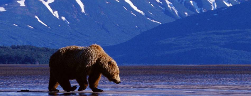
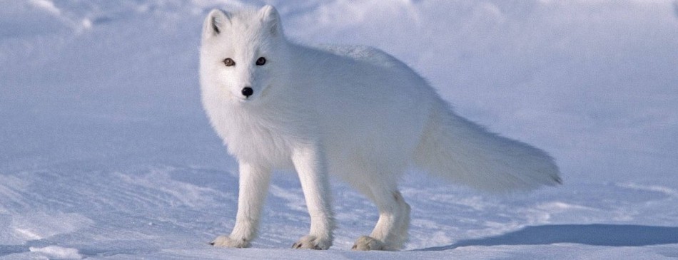
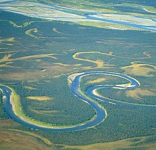
Canoeing the Noatak through Alaska’s Gates of the Arctic National Park and Preserve is truly a trip of a lifetime. Paddling down this gentle old glacial river, we wind in a serpentine fashion down a stream of turquoise and green hues surrounded by a gentle landscape of multi-hued tundra.  Wildlife abound and can be viewed by all. Caribou migrate across the river, barren land grizzlies waddle up the river banks looking for salmon, dall sheep graze on distant hillsides, arctic foxes are darting around our kitchen, wolves relentlessly stalk their prey, and golden eagles, gyrfalcons, merlins, short-eared owls, and harriers cover the aerial environs.

The first half of the Noatak River is shallow, from 4” to 3’ in depth, approximately 75’ wide, and flows about 3 m.p.h. There are few rapids.  The river follows the valley with little meandering.  It is accessible only by floatplane.

The 2nd half of the Noatak River has water depths of 4' – 15’, varies from 75' – 500’ in width, with flow increasing up about 6 M.P.H. The water was crystal clear and remained so for the rest of the entire river even in depths of 12' – 15’. The number and size of rapids doubled in this area of the Noatak River. However, a route through was generally easily found. The rapids required zigzagging to transverse. Rapids were the only hazard. The Noatak River from Noatak Canyon to the Kelly River meanders little; then becomes extremely braided to its mouth.


Search:

Noatak river area in Alaska


Noatak River winds through alaska


Alaska Rivers:

Alaska has more than 12,000 rivers including the nine major rivers listed below:

Learn more about Alaskan rivers

Colville River Copper River Gulkana River
Kuskokwim River Noatak River Porcupine River
Susitna River Tanana River Yukon River.