|
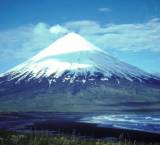
Of the 20 highest peaks in the
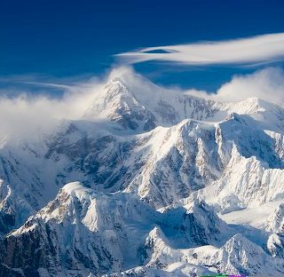
United States, 17 are in Alaska. Mt. McKinley, the
highest peak in North America, is 20,320 ft. above sea
level. Denali, the Indian name for the peak, means "The
Great One." The forces that lifted Mount McKinley is
the subduction of the Pacific plate beneath the North
American plate.. This plate also raised great ranges
across southern Alaska. As that huge sheet of
ocean-floor rock plunges downward into the mantle, it
shoves and crumples the continent into soaring mountains
which include some of the most active volcanoes on the
continent. Mount McKinley in particular is uplifted
relative to the rocks around it because it is at the
intersection of major active strike-slip faults (faults
that move rocks laterally across the Earth's surface)
which allow the deep buried rocks to be unroofed more
rapidly compared to those around them.
Mt. McKinley, or Mt. Denali, is much taller than Mt.
Everest. In fact, Denali is one of the most massive
mountains in the world. Mt. McKinley has been the goal
of aspiring high altitude climbers since it was first
climbed in 1913. Its reputation as a highly coveted
summit derives from its location near the Arctic Circle
and the Pacific Ocean giving it some of the most
ferocious weather in the world.
In the south and southeast, the Pacific Mountain system
is a major feature and is divided into many
subdivisions. The Chugach Mountains begin near the
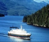
Alaskan panhandle and form the coast along much of
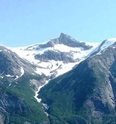
Southcentral Alaska. These mountains contain the
greatest concentration of glacial ice in Alaska. As the
warm, moist winter air off the ocean meets these
mountains and cools, it creates some of the highest
snowfall in Alaska. During the winter of 1952-1953,
Thompson Pass near Valdez received about 81 feet (25
meters) of snow. A major fault in Prince William Sound
is contributing to the ongoing formation of these
mountains. In 1964, this fault slipped, creating the
Good Friday Earthquake that severely damaged Anchorage
and destroyed several smaller communities including
Chenega, Seward, and Valdez.
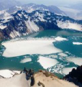
The Kenai Mountains cover all but the northern and
western portions of the Kenai Peninsula. Many
glacier-carved lakes dot the Kenai Peninsula, including
Kenai Lake, Upper Russian Lake, and Trail Lakes. Many
recreational hiking trails cut through the Kenai
Mountains .A popular attraction in the Kenai Mountains
is the fjords created where the east coast of the Kenai
Peninsula meets Prince William Sound.
The Alaska Range is perhaps the most well-known mountain
range in Alaska. It is home to Denali National Park and
Mt. McKinley. This mountain range is one of Alaska's
largest, starting at Alaska's eastern border with
Canada, arcing across the north of Southcentral Alaska,
ending to the west of the Kenai Peninsula.
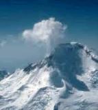
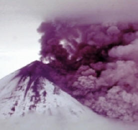
The Alaskan Range is still changing. Spurr, an active
volcano west of Anchorage erupted in 1992 and covered
Anchorage with a thin layer of ash. On November 3, 2002,
a massive 7.9 earthquake was caused by a fault running
through the Alaska Range. For several weeks afterwards,
thousands of aftershocks were recorded. Due to Alaska's
sparse population, earthquake damage was only about $20
million.
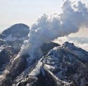
Extending southwest from the southern Alaska mainland
and the Alaska Range, the Alaska Peninsula and the
Aleutian Islands are supported by the Aleutian Mountain
Range. The Aleutian Range extends 1,600 mile, from Mount
Spurr, across Cook Inlet from Anchorage, to Attu Island
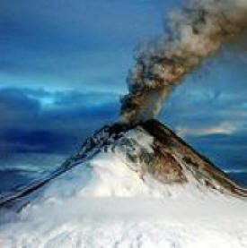
near the Asian continent and contains many active
volcanoes. Collision between continental plates has
created a 1,400 mile (2,253 km) chain of active
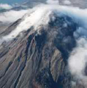
volcanoes in this mountain range. This range is home to
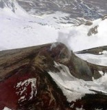
the Valley of Ten Thousand Smokes, created when
Novarupta erupted in 1912. The Valley of Ten Thousand
Smokes was named for the numerous fumaroles in the area.
Fumaroles are holes in the earth that release hot gas
steam into the air.
North of the Central Uplands and Lowlands area is the
Rocky Mountain System of Alaska. This area is comprised
of the Brooks Range and the Brooks Range foothills. The
Brooks Range is Alaska's northernmost mountain range,
all of it being located above the arctic circle. This
range stretches about 720 miles (1,159 km) from Alaska's
eastern border with Canada to the Chukchi Sea off
Alaska's west coast. Despite their northerly location
and cool temperatures, there are few glaciers in this
mountain range; this area is rather arid so not enough
snow falls during the winter to create large glaciers.
The largest glaciers in the Brooks Range aren't much
longer than file miles Arrigetch Peaks, considered by
many to be the most dramatic peaks of the western Brooks
Range, perhaps the most dramatic in all of Alaska.
|